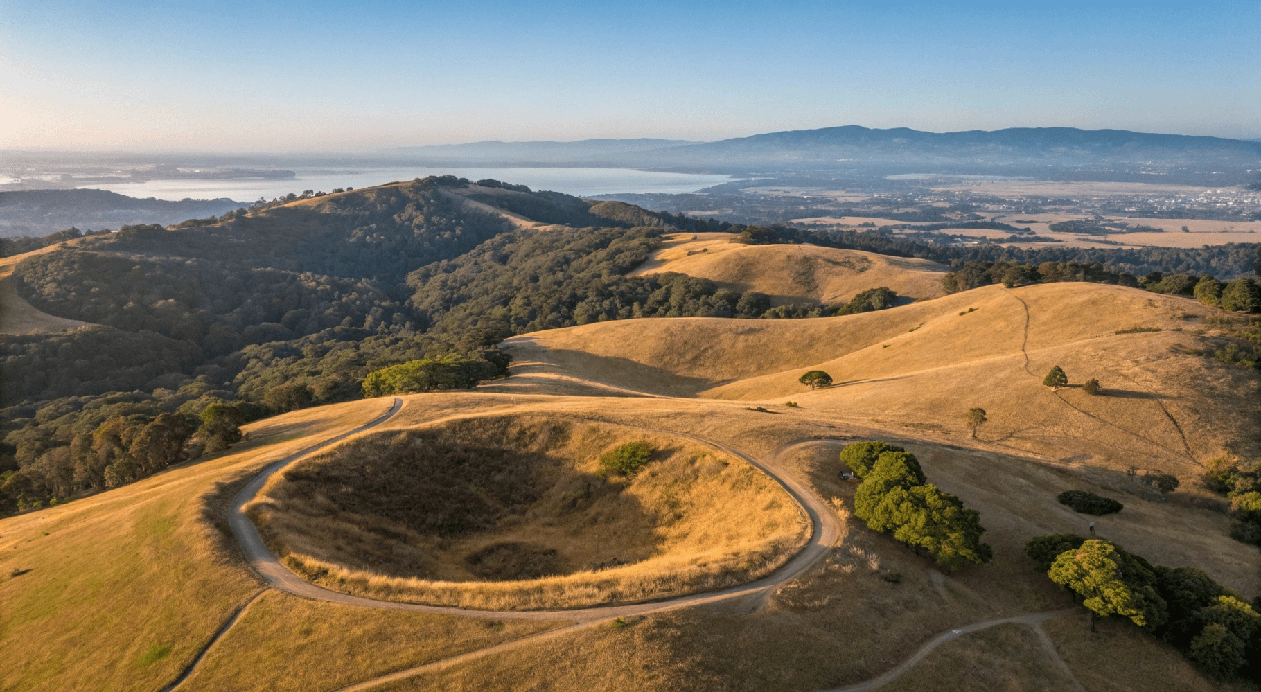
Hidden in the Oakland Hills lies one of the Bay Area’s most fascinating geological wonders—Sibley Volcanic Regional Preserve. This unique park offers visitors the rare opportunity to explore the remnants of an ancient volcano, discover mysterious stone labyrinths, and enjoy panoramic views of the Bay Area, all within a surprisingly accessible setting. Whether you’re a geology enthusiast, avid hiker, or simply looking for a peaceful escape from city life, Sibley Volcanic Regional Preserve delivers an experience unlike any other in the region.
Table of Contents
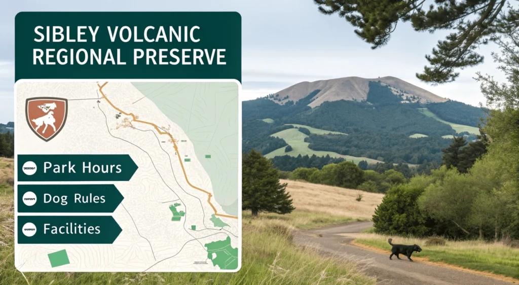
Quick Facts
| Information | Details |
|---|---|
| Location | Oakland Hills (Skyline Blvd), Oakland, CA |
| Hours | 5:00 AM to 10:00 PM daily |
| Entrance Fee | Free |
| Parking | Free lot (limited capacity, ~30 spaces) |
| Dogs | Allowed on leash on all trails |
| Restrooms | Available near main parking lot |
| Official Website | East Bay Parks – Sibley Volcanic |
Why Visit Sibley?
Volcanic History
Step back 10 million years and walk through what was once an active volcano. Unlike most volcanic sites that require remote travel, Sibley brings this geological wonder right to the urban edge of Oakland.
The Labyrinths
Perhaps Sibley’s most intriguing feature is its collection of stone labyrinths. Created by local artists and maintained by visitors, these mysterious formations add an element of wonder to your hike, with the heart-shaped labyrinth being particularly photogenic.
Hiking Variety
From paved accessible trails to challenging loops with significant elevation gain, Sibley offers hiking experiences for every ability level. The interconnected trail system allows visitors to customize their adventure.
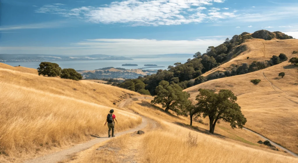
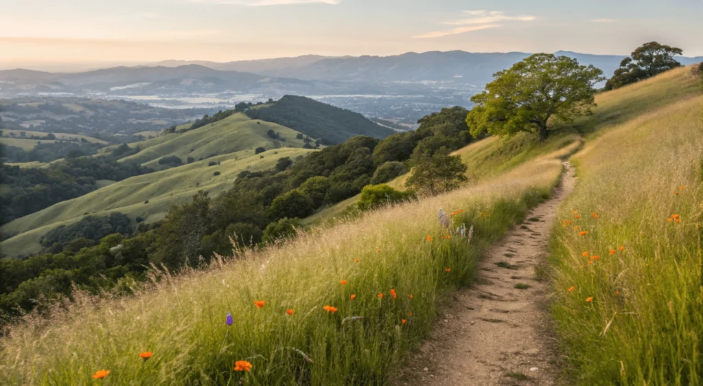
Bay Area Views
On clear days, panoramic vistas stretch from Mount Diablo to San Francisco and beyond. The higher elevations of the preserve provide some of the best viewpoints in the entire East Bay Regional Park system.
Dog-Friendly Trails
Unlike some parks with restricted areas, Sibley welcomes leashed dogs throughout the preserve, making it a favorite destination for Oakland and Berkeley dog owners.
Accessibility
The Quarry Trail offers a paved section suitable for wheelchairs and strollers, ensuring that even visitors with mobility challenges can experience portions of this volcanic landscape.
Getting There & Logistics
Driving Directions
From Oakland/Berkeley: Take Highway 13 to Joaquin Miller Road/Lincoln Avenue exit. Head east uphill on Joaquin Miller Road. Turn left onto Skyline Boulevard and continue approximately 2 miles. The Sibley Staging Area will be on your right.
From San Francisco: Cross the Bay Bridge toward Oakland. Take Highway 580 East, then transition to Highway 13 North. Follow directions above from Highway 13.
From Contra Costa County: Take Highway 24 west toward Oakland. Exit at Fish Ranch Road and turn left. At the top of the hill, turn right onto Grizzly Peak Boulevard. Continue to Skyline Boulevard and turn left. The preserve entrance will be on your left after about 1 mile.
Parking
The main lot at Sibley Volcanic Regional Preserve contains approximately 30 spaces and can fill up on weekends and holidays, especially between 10 AM and 2 PM. Arrive early (before 9 AM) or later in the afternoon (after 3 PM) for the best chance at finding parking.
Alternative Parking: Street parking is available along Skyline Boulevard, but always check signage for restrictions. Never block driveways or emergency access points.
Hiking Trails In-Depth
Trail Map Overview
The preserve offers approximately 14 miles of trails through diverse terrain. While the official park PDF map can be confusing, the main trails form several interconnected loops that allow hikers to customize their experience.
Round Top Loop Trail
Stats:
- Difficulty: Moderate
- Distance: 3.1 miles (full loop)
- Elevation Gain: 750 feet
- Estimated Time: 1.5-2 hours
- Type: Loop
Experience: This signature trail circles Round Top, a 1,763-foot peak that forms the most prominent remnant of the ancient volcano. The trail offers a mix of open grasslands and oak woodlands with impressive views of the calderas. The western portion features steep sections with loose gravel, requiring sturdy footwear.
Best For: Geology enthusiasts and photographers. This trail provides the most comprehensive volcanic experience in the preserve.
Key Points: “sibley volcanic regional preserve”
- Begin at the main parking lot and follow signs for Round Top Loop
- At the 0.7-mile mark, you’ll reach an interpretive sign explaining the volcanic formation
- Continue clockwise for a more gradual ascent
- The northern portion offers the best Bay views on clear days
Volcanic Trail
Stats: “sibley volcanic regional preserve”
- Difficulty: Easy to moderate
- Distance: 1.1 miles (one-way)
- Elevation Gain: 300 feet
- Estimated Time: 45 minutes
- Type: Out-and-back (can be incorporated into longer loops)
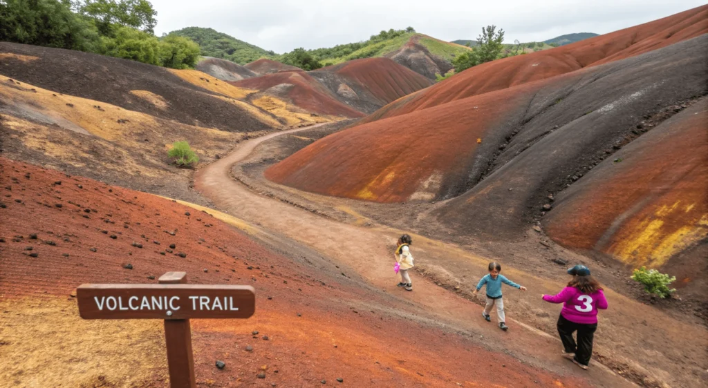
Experience: This educational trail features multiple interpretive signs that explain Sibley’s volcanic origin. The trail passes directly through portions of the ancient caldera, with visible layers of volcanic ash and basalt. You’ll find several numbered markers corresponding to the geology guide available at the visitor center.
Best For: Families with curious children and geology beginners. The educational signs make this trail particularly valuable for first-time visitors.
Turn-by-Turn Highlights: “sibley volcanic regional preserve”
- From the main parking area, head east on the paved path
- After 0.2 miles, take the dirt path leading south into the crater
- Follow the numbered posts, stopping to read the interpretive information
- Note the dramatic color changes in the soil, signifying different volcanic materials
Quarry Trail
Stats: “sibley volcanic regional preserve”
- Difficulty: Easy
- Distance: 0.8 miles
- Elevation Gain: Minimal (mostly level)
- Estimated Time: 20-30 minutes
- Type: Linear
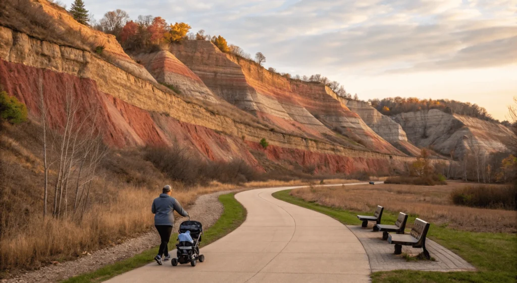
Experience: The most accessible trail in the preserve, this paved path follows the route of an old quarry road. It provides excellent views of the exposed volcanic layers in the quarry walls. The trail is wide and mostly level, making it suitable for wheelchairs, strollers, and those with mobility challenges.
Best For: Visitors seeking accessibility, families with very young children, and those interested in seeing the exposed geology without significant hiking.
Key Features: “sibley volcanic regional preserve”
- Accessible restrooms at the trailhead
- Multiple benches for resting
- Excellent viewpoints of the quarry’s exposed volcanic layers
- Easy access to the main labyrinth (via short spur trail)
Skyline Trail
Stats: “sibley volcanic regional preserve”
- Difficulty: Moderate to challenging
- Distance: 2.5 miles (one-way across preserve)
- Elevation Gain: 600 feet (with several up-and-down sections)
- Estimated Time: 1.5 hours
- Type: Linear, but can be incorporated into loops
Experience: This trail runs along the eastern ridge of the preserve, offering dramatic views of both the Oakland hills and the San Leandro reservoir. The trail alternates between shaded oak groves and exposed grasslands. In spring, this trail features impressive wildflower displays.
Best For: Hikers seeking a longer, more challenging route with maximum scenic diversity. Also excellent for birders, as the varied habitats attract numerous species.
Seasonal Notes: This trail can be quite hot in summer due to limited shade. In winter and spring, portions may become muddy after rain.
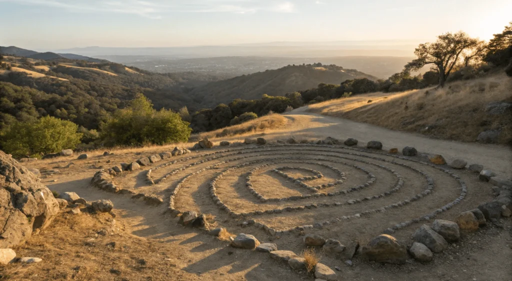
The Famous Labyrinths
What Are They?
Sibley’s stone labyrinths represent one of the preserve’s most unique features. The primary labyrinth, created by artist Helena Mazzariello in the 1990s, sits within an old quarry pit. Over time, additional labyrinths have appeared, created by anonymous artists and maintained by visitors. These are not official park features but have become beloved landmarks that blend art with nature.
How to Find Them “sibley volcanic regional preserve”
Finding the main labyrinth requires some exploration, which adds to the adventure:
- Start at the main parking lot and take the Quarry Trail (paved path)
- After approximately 0.4 miles, look for a dirt path leading downhill to your left
- Follow this path down into the quarry bowl for about 300 feet
- The main labyrinth will appear in the center of the quarry floor
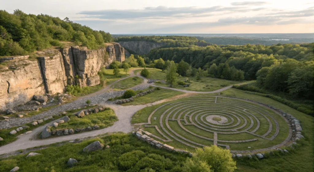
GPS Coordinates for Main Labyrinth: 37.843201, -122.199656
For the heart-shaped labyrinth:
- Continue past the main labyrinth and follow the path that curves around the quarry bowl
- Look for a smaller pit area to your right after approximately 800 feet
- The heart-shaped labyrinth will be visible from above
Labyrinth Etiquette
- Walk the labyrinths respectfully, following their patterns
- Do not disturb or rearrange the stones
- Keep dogs leashed and away from the stone arrangements
- Leave only footprints, take only photographs
- Consider leaving a small stone as a token of your visit (a tradition among some visitors)
Unearthing the Volcanic Past
Sibley’s Geological Formation
Approximately 10 million years ago, this area was a “maar” volcano—a type formed when rising magma meets groundwater, causing steam explosions that create wide, shallow craters. What makes Sibley unique is that subsequent tectonic activity has tilted the entire volcano formation, providing visitors with an unusual cross-section view of the volcanic structure.
Maar volcanoes like Sibley form through explosive interactions between magma and groundwater—learn more in this USGS primer on volcanic landforms.
The volcano’s main eruption lasted only a brief time in geological terms, but it left behind a complex structure that includes the main crater (now Round Top Peak), multiple lava flows, and distinctive volcanic sediments. “sibley volcanic regional preserve”
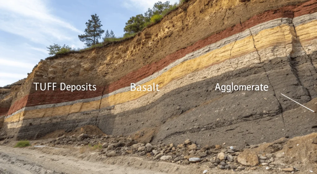
Key Features to Observe
Round Top Peak: Once the central vent of the volcano, now standing at 1,763 feet.
Basalt Formations: Look for dark, dense rock formations, particularly visible in the quarry walls. These represent solidified lava flows.
Tilted Layers: Unlike most volcanoes where layers are horizontal, Sibley’s layers tilt at roughly a 30-degree angle due to later tectonic movement—a relatively rare feature that makes the geological history more visible. “sibley volcanic regional preserve”
Tuff Deposits: The light-colored, softer rock represents volcanic ash and debris from explosive eruptions.
Agglomerate: Areas containing larger rock fragments embedded in finer material, evidence of violent eruptive phases.
For those interested in more detailed geological information, the USGS offers comprehensive studies of the Berkeley Hills volcanic formations. The visitor center also provides educational materials, including a detailed guide corresponding to numbered markers along the Volcanic Trail.
Flora, Fauna & Ecology

Plant Life “sibley volcanic regional preserve”
Sibley’s varied topography creates multiple microhabitats supporting diverse plant communities:
Oak Woodland: Coast live oaks and California bay laurels dominate the cooler north-facing slopes, creating shaded habitats with rich understory plants.
Grasslands: Open, sunny areas feature native bunchgrasses interspersed with seasonal wildflowers. Look for California poppies, lupines, and buttercups in spring.
Chaparral: Drought-adapted shrubs like manzanita, coyote brush, and chamise thrive on the warmer south-facing slopes.
Seasonal Highlights: “sibley volcanic regional preserve”
- Spring (March-May): Peak wildflower season with poppies, lupines, owl’s clover, and goldfields
- Summer (June-August): Grasses turn golden, buckeyes bloom
- Fall (September-November): Subtle fall colors in the deciduous oaks, berries on toyon
- Winter (December-February): Vibrant green grasses after rains, early wildflowers beginning in February
Wildlife “sibley volcanic regional preserve”
The preserve hosts a variety of East Bay wildlife, though many animals are more active during early morning or evening hours:
Birds: Red-tailed hawks, turkey vultures, acorn woodpeckers, California quail, dark-eyed juncos, and numerous songbirds.
Mammals: Black-tailed deer, gray foxes, coyotes, ground squirrels, and occasionally bobcats (primarily at dawn/dusk).
Reptiles: Western fence lizards, alligator lizards, gopher snakes, and rarely, rattlesnakes (be aware but not alarmed).
Best Wildlife Viewing Times: Early morning (7-9 AM) and late afternoon (4-6 PM) typically offer the best wildlife sightings.
A Brief History
Before becoming a regional preserve, this land held significance for both indigenous peoples and later settlers:
Ohlone Presence: For thousands of years, the Ohlone people inhabited the East Bay region, including these hills. They used the area for gathering materials, hunting, and seasonal movements between the bay shoreline and inland areas. “sibley volcanic regional preserve”
Quarrying Era: Beginning in the 1920s and continuing until the 1970s, portions of Sibley were quarried for volcanic rock used in road construction and landscaping. This industrial activity actually helped expose many of the geological features visitors appreciate today.
Preservation: In 1976, the East Bay Regional Park District acquired the initial portion of what would become Sibley Volcanic Regional Preserve, naming it after Robert Sibley, a founder and longtime director of the park district who championed public access to natural spaces.
Planning Your Visit
Best Times to Go
Seasons: “sibley volcanic regional preserve”
- Spring (March-May): Ideal for wildflowers, green hillsides, and moderate temperatures
- Fall (October-November): Clear skies often provide the best long-distance views
- Winter (December-February): Dramatically green landscapes after rains, but trails can be muddy
- Summer (June-September): Early morning recommended to avoid afternoon heat, especially on exposed trails
Time of Day: Arrive early (8-10 AM) for cooler temperatures, better wildlife viewing, and easier parking. Late afternoon (4-6 PM) offers beautiful light for photography.
What to Pack
Essentials: “sibley volcanic regional preserve”
- Water (at least 1 liter per person, more in summer)
- Sun protection (hat, sunscreen, sunglasses)
- Layered clothing (Bay Area microclimates can change quickly)
- Trail map (available at entrance kiosk or downloadable from East Bay Parks website)
- Sturdy hiking shoes with good traction
Recommended: “sibley volcanic regional preserve”
- Binoculars for wildlife viewing
- Camera for volcanic features and panoramic views
- Snacks or picnic lunch (no food services in the preserve)
- Trekking poles for steeper sections if needed
Safety Tips
Natural Hazards: “sibley volcanic regional preserve”
- Poison Oak: Learn to identify and avoid this three-leafed plant (“leaves of three, let it be”)
- Ticks: Stay on trails and check yourself after hiking, particularly in spring
- Rattlesnakes: Uncommon but present—watch where you step and never reach into rock crevices
- Weather: Fog can roll in quickly, reducing visibility and temperatures
Trail Safety:
- Carry a map and be aware of trail junctions
- Let someone know your planned route and return time
- Cell service is spotty in portions of the preserve
- Stay on designated trails to prevent erosion and habitat damage
Accessibility Details
The Quarry Trail offers the most accessible experience:
- Paved surface suitable for wheelchairs and mobility devices
- Approximately 0.8 miles of relatively level terrain
- Accessible restrooms at the main staging area
- Several benches along the route
- Interpretive signs at comfortable viewing height
For visitors with limited mobility but who can handle some uneven terrain, the first portion of the Volcanic Trail provides access to some geological features without significant elevation change.
Visitor Etiquette & Park Rules
Sibley’s continued preservation depends on responsible visitor behavior:
- Leave No Trace: Pack out all trash and belongings
- Dog Rules: Pets must remain on leash (maximum 6 feet) at all times
- Stay on Designated Trails: Off-trail hiking damages fragile plant communities and increases erosion
- No Smoking: Fire danger is high, especially in summer and fall
- No Collection: Leave rocks, plants, and natural objects in place for others to enjoy
- No Drones: Unmanned aircraft are prohibited without special permission
- Quiet Hours: Respect other visitors by keeping noise levels reasonable
- Bicycles: Allowed only on designated fire roads, not single-track trails
Nearby Attractions & Making a Day of It
Sibley’s location makes it easy to combine with other East Bay experiences:
Adjacent Parks: “sibley volcanic regional preserve”
- Huckleberry Botanic Regional Preserve: Just north of Sibley, offering a completely different ecosystem with rare native plants
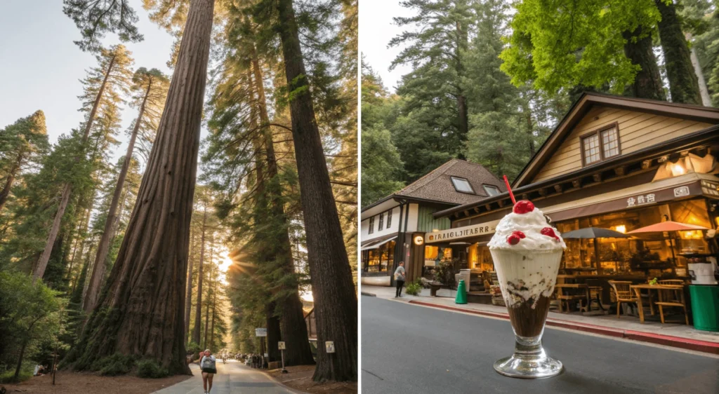
- Redwood Regional Park: Ancient redwood forest just 5 minutes away by car
- Tilden Regional Park: Berkeley’s beloved park with a botanical garden, small farm, and lake
Local Dining: After your hike, refuel at nearby Montclair Village (10-minute drive):
- Coffee shops and casual cafes perfect for post-hike refreshments
- Several small restaurants offering lunch and dinner options
For a true East Bay experience, consider stopping at Fenton’s Creamery in Oakland’s Piedmont neighborhood on your way back. This historic ice cream parlor has been serving massive sundaes and scoops since 1894—a perfect reward after exploring Sibley’s volcanic wonders.
Conclusion
Sibley Volcanic Regional Preserve offers a uniquely accessible window into the Bay Area’s geological past. From the mysterious stone labyrinths to the exposed volcanic features, from ridge-top panoramas to peaceful oak woodlands, this compact preserve packs remarkable diversity into its trail system. Whether you come for a quick nature escape, a geological exploration, or a challenging hike, Sibley rewards visitors with experiences uncommon in urban park systems. “sibley volcanic regional preserve”
As development continues to transform the Bay Area, places like Sibley become increasingly precious—living museums where natural processes remain visible and accessible. By visiting respectfully and understanding what makes this place special, you help ensure its preservation for future generations of curious explorers.
About the Author
This guide was written by an East Bay native and avid hiker with over 15 years of experience exploring the regional parks system. Having visited Sibley in all seasons and weather conditions, I’ve developed a deep appreciation for this volcanic treasure hidden in plain sight of the Bay Area’s urban landscape. My background in geology and natural history education helps inform the observations and insights shared in this guide. “sibley volcanic regional preserve”
