
Hiking offers a unique way to experience Atlanta’s stunning skyline and lush landscapes. The city’s diverse topography creates perfect spots for breathtaking views. From the rolling hills to the urban skyline, Atlanta’s hiking trails provide a blend of nature and city life. Discovering these scenic trails not only enhances your outdoor activities in Atlanta but also allows you to appreciate the panoramic views Atlanta has to offer. Whether you’re a seasoned hike view over atlanta or a casual walker, the city’s trails promise unforgettable experiences.
Table of Contents
Understanding the Atlanta Hiking Scene: What to Expect

Atlanta offers a diverse range of hiking trails suitable for all skill levels. Expect a mix of urban and natural landscapes. Trails vary from easy walks to challenging hikes. Terrain includes hills, forests, and rivers. Summer heat can be intense; plan hikes for early morning or late afternoon. Crowds are common on weekends, especially at popular spots. Always check the weather before heading out. Stay hydrated and wear appropriate gear. Respect trail etiquette: yield to others, stay on marked paths, and pack out what you pack in.
Top Hike Views Over Atlanta: Detailed Trail Guides
Trail Name 1: Kennesaw Mountain
Location: Kennesaw Mountain National Battlefield Park, 900 Kennesaw Mountain Dr NW, Kennesaw, GA 30152. Trail Stats: 2.5 miles round trip, 800 ft elevation gain, moderate difficulty, out-and-back. View Highlights: Stunning panoramic views of the Atlanta skyline and surrounding mountains. Trail Description: Rocky terrain with historical markers, lush forests, and a scenic overlook. Learn more about the historical significance of this site on the official National Park Service page ,Parking & Accessibility: Ample parking available, no fees, dog-friendly. Best Time to Visit: Early morning for sunrise views or fall for vibrant foliage.
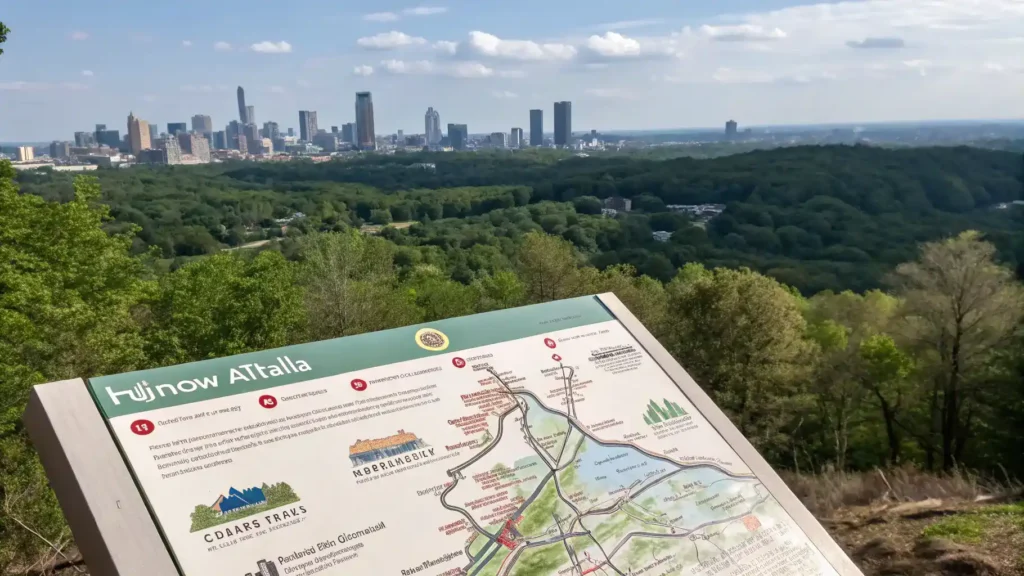
Trail Name 2: Stone Mountain
Location: 1000 Robert E Lee Blvd, Stone Mountain, GA 30083. Trail Stats: 1.3 miles to the summit, 600 ft elevation gain, strenuous, loop. View Highlights: Breathtaking views of Atlanta and the surrounding area from the summit. Trail Description: Paved and rocky paths, with a large granite dome and unique rock formations. Parking & Accessibility: Paid parking available, accessible for all skill levels, dog-friendly. Best Time to Visit: Sunset for a magical view of the city lights.

Trail Name 3: Arabia Mountain
Location: Arabia Mountain National Heritage Area, 3787 Klondike Rd, Lithonia, GA 30038. Trail Stats: 2.5 miles round trip, minimal elevation gain, easy, loop. View Highlights: Unique granite outcrops and views of the surrounding wetlands. Trail Description: Smooth trails with wildflowers, rock formations, and historical sites. Parking & Accessibility: Free parking available, suitable for all skill levels, dog-friendly. Best Time to Visit: Spring for wildflower blooms and clear skies.
Trail Name 4: Pine Mountain
Location: Pine Mountain Trail, 1000 Pine Mountain Rd, Pine Mountain, GA 31822. Trail Stats: 23 miles total, various sections, moderate to strenuous, loop. View Highlights: Scenic overlooks with views of the Chattahoochee Valley and Atlanta skyline. Trail Description: Diverse terrain with forests, streams, and rocky outcrops. Parking & Accessibility: Parking available at various trailheads, some sections may be challenging. Best Time to Visit: Fall for stunning foliage and cooler temperatures.
Trail Name 5: Sweetwater Creek State Park
Location: 1750 Mt Vernon Rd SW, Lithia Springs, GA 30122. Trail Stats: 5 miles round trip, 300 ft elevation gain, moderate, loop. View Highlights: Views of the creek and historic mill ruins. Trail Description: Scenic trails with river views, wildlife, and lush vegetation. Parking & Accessibility: Parking available, small fee, dog-friendly. Best Time to Visit: Spring for blooming flowers and wildlife activity.

Trail Name 6: Red Top Mountain
Location: 50 Lodge Rd SE, Cartersville, GA 30121. Trail Stats: 6 miles round trip, 500 ft elevation gain, moderate, loop. View Highlights: Beautiful views of Lake Allatoona and the surrounding hills. Trail Description: Forested trails with lake access and picnic areas. Parking & Accessibility: Parking available, small fee, dog-friendly. Best Time to Visit: Summer for water activities and vibrant greenery.
Beyond the Views: Enhancing Your Hiking Experience
To fully enjoy the breathtaking hike view over Atlanta, consider these essential tips for an enhanced hiking experience.
Gear Recommendations
Invest in quality hiking boots for comfort and support. Carry a reusable water bottle to stay hydrated. A sturdy backpack is essential for carrying supplies. Don’t forget sunscreen to protect your skin. A wide-brimmed hat can shield you from the sun.
Safety Tips
Always stay on marked trails to avoid getting lost. Be aware of changing weather conditions before and during your hike. Inform a friend or family member about your hiking plans for safety.
Leave No Trace Principles
Respect the environment by minimizing your impact. Pack out what you pack in, including trash. Stay on designated paths to protect local flora and fauna.
Photography Tips
Use natural light for the best photos, especially during golden hour. Capture wide-angle shots to showcase panoramic views Atlanta offers. Experiment with different angles to find unique perspectives.
Planning Your Hike: Getting to the Trailhead & Making the Most of Your Trip
When planning your hike view over Atlanta, knowing how to get to the trailhead is essential. Here are some tips to help you navigate your journey.
Transportation Options
Driving is the most convenient way to reach hiking trails Atlanta. Use GPS for accurate directions. Public transportation is available, with MARTA providing access to some trailheads. Rideshare services like Uber and Lyft are also options for those without a vehicle.
Nearby Attractions
Explore nearby attractions after your hike. Check out local restaurants for a post-hike meal. Parks and historical sites can enhance your outdoor activities Atlanta experience. Consider visiting the Atlanta Botanical Garden or the Martin Luther King Jr. National Historical Park.
Local Tips
To avoid crowds, hike during weekdays or early mornings. Research hidden gems along scenic trails Atlanta for a unique experience. Bring plenty of water and snacks to stay energized. Always check the weather before heading out to ensure a safe hike.

Conclusion: Embrace Atlanta’s Beauty One Hike at a Time
Hiking near Atlanta offers breathtaking views and a chance to connect with nature. The scenic trails Atlanta has to offer provide a perfect escape from city life. Each hike reveals unique panoramic views Atlanta is known for. Exploring these trails not only enhances physical well-being but also promotes mental clarity. Whether you’re a seasoned hiker or a beginner, the best hikes near Atlanta cater to all skill levels. Embrace the outdoors and discover the hidden gems of Atlanta’s natural beauty one hike at a time.
